Data and digital tech is transforming the frequency of our interactions with the real world and making them more meaningful. Mapping and modeling solutions provide critical layers of data aggregation and geo-spatial infrastructure for several government, enterprise and utility services.

With deep capabilities in geospatial technologies, IoT and AI/ML combined with a well-trained large skilled team, Cyient has spearheaded the development of mapping and modeling solutions across industries.

core-mapping-services

Core mapping/ navigation services

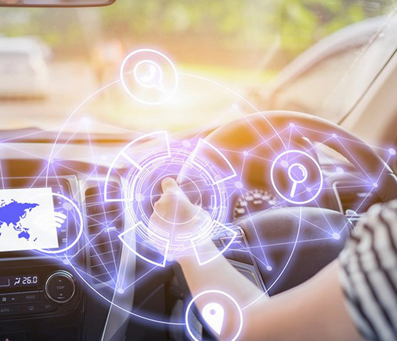
From Smart Cities to Business efficiency, nothing is out of reach when the right navigation solutions meet powerful data acquisition and processing solutions.

  • HD and SD Mapping editing and creation
  • Geo basemap enhancement including navigation, POI, traffic, weather, and general Geo platform management
openstreetmap-services

OpenStreetMap Services and Solutions

Leverage OSM platform and data to deliver strategic mapping and modeling solutions with deep customizations, greater flexibility and lower costs.

  • Integrate and enhance OSM platform and data
  • Geo Services including POI, HD Mapping, Navigation, and Digital applications
  • Integrate "third-party" and customer Data to deliver strategic Geo platforms and solutions
autonomous-vehicles

Autonomous and Connected vehicles

Stay future-ready with your autonomous vehicle by integrating sensors to map and deploying emerging digital technologies.

  • Integrate "Sensor" data from vehicle to enhance current Geo base map
  • Create HD maps to meet level 2 and 3 autonomous vehicle solutions
  • Apply "Digital" technologies such as AI, ML and Predictive Analysis

Industry Solutions

Cyient has harnessed the power of location with digital technologies to deliver value for public utilities, communication and network service providers, autonomous vehicles, mining companies, urban mobility services and agriculture.

Transport-and-Navigation

Transport and Navigation

  • Autonomous Driving Data Processing
  • ADAS Geometry for Better Navigation
  • 3D Landmarks/ 3D City Models for Enhanced Visualization
  • Airport Mapping Services for Safer Travel
  • Road Assets & Pavement Distress Reports
  • And more
Commercial-Services

Commercial Services

  • Hyperlocal maps
  • Last mile connectivity planning
  • Logistics and supply chain management
  • Targeted location based marketing
  • Gaming/Metaverse and more
Auto

Auto

  • Basic navigation services
  • Building additional POIs
  • Emergency Services
  • And more
Network-and-Communications

Network and Communications

  • Wired and wireless mapping
  • Network fault detection
  • Field servicing
  • Customer qualification
  • And more
Utilities

Utilities

  • Network outage management
  • Field Ops management
  • Resource consumption and analytics
  • And more
Government-services

Government Services

  • Optimizing navigation for emergency services
  • Multi-modal transportation made easier
  • Smart City Solutions
  • Road, Rail and Asset management
  • GIS planning
  • And more
Agriculture-Solutions

Agriculture Solutions

  • Agricultural monitoring: Automated Crop Classification
  • Habitat monitoring
  • National Monitoring
  • And more
Mining

Mining

  • Ore reserve estimation
  • Change detection
  • Stockpile monitoring
  • Supply chain management
  • And more

Pinpointed Solutions that give you a headstart

Geospatial-Powered Solutions | Cyient

Learn More

Underground Mapping solutions

Learn More

Leveraging Geospatial Information for Improved Business Efficiency

Download Brochure

Scalable Mapping and Modelling Solutions for Better Decision Making

Download Brochure

Data Acquisition and Processing Solutions

Learn More

Building Resilient and Sustainable Cities

Download Brochure

Reduce road maintenance costs and Improve Drivability and safety

Download Brochure

End to End editing platform to migrate to OSM without investing on the Platform and Software

Talk To Us

Services that drive greater business efficiency

Cyient enables superior decision making on all fronts with actionable insights gleaned from the sophisticated data footprint of mapping technologies and operations.

  • Data Acquisition
  • Map updates and edit
  • Map data verification and standardization
  • Application development and integration - Web and Mobile

Insights and Opinions

AI-Machine
Blog

AI and Machine Learning Will Pave the Way for Building Maps for Driverless Cars

AI and Machine Learning Will Pave the Way for Building Maps for Driverless Cars Btn_Cyi_Tel_Sec05_Next_In01-1
Img_Cyi_Tel_Sec05_In01
Case Study

Mapping a course in global Road Networks for TomTom

Mapping a course in global Road Networks for TomTom Btn_Cyi_Tel_Sec05_Next_In01-1