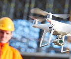
Aerial Photography
Fixed-wing and rotary wing aerial photography and videography for inspection purposes.
Hyperspectral Imaging
Hyperspectral imaging in VNIR, NIR, and SWIR wavelengths.
LiDAR
Fixed-wing and rotary wing LiDAR data capture, processing, and ortho creation.
Mobile Laser Scanning
Highly accurate surveying system for signage detection, topographic mapping, vegetation, and encroachment management.


