close

Categories

Subscribe to Email Updates

Recent Stories

Toward Seamless GIS-ADMS Integration in Electrical Utilities | Cyient Blog
Toward Seamless GIS-ADMS Integration in Electrical Utilities | Cyient Blog Cyient
Toward Seamless GIS-ADMS Integration in Electrical Utilities | Cyient Blog
From Bandwidth to Bliss: Future of Fiber-Based Communications Technology
From Bandwidth to Bliss: Future of Fiber-Based Communications Technology Cyient
From Bandwidth to Bliss: Future of Fiber-Based Communications Technology
IT Culture: Embracing Enterprise Vision for Digital Transformation
IT Culture: Embracing Enterprise Vision for Digital Transformation Cyient
IT Culture: Embracing Enterprise Vision for Digital Transformation
A 2024 perspective of power distribution ft. AI and data
A 2024 perspective of power distribution ft. AI and data Cyient
A 2024 perspective of power distribution ft. AI and data
Technology Priorities for a CTO that Will Fuel Innovation & Collaboration in 2024
Technology Priorities for a CTO that Will Fuel Innovation & Collaboration in 2024 Cyient
Technology Priorities for a CTO that Will Fuel Innovation & Collaboration in 2024
Gareth Bathers Gareth Bathers Written by Gareth Bathers, He is responsible for deciding Cyient Europe's strategy with regards to our Geospatial capability.
on 24 Jul 2020

Without a doubt, the COVID-19 pandemic has led to an unprecedented disruption across all aspects of life and work. We have heard about the impact of the outbreak across industries, and how certain services will change in the post-COVID-19 world. But how significantly will the COVID-19 fallout shape geospatial services?

Governments across the world are already leveraging geospatial services and solutions to fight the COVID-19 war. GIS mapping has never been this relevant, and many countries rely on it to provide timely and accurate COVID-19-related information to help authorities make informed decisions and well thought out strategies. While the use of geospatial technologies amongst government organizations is now witnessing an uptake, these technologies are also set to transform the landscape for businesses.

On the business application side, advances in computing have resulted in a surge in the use of geospatial analytics across all major sectors and businesses. Moreover, geospatial data can be collected remotely - satellite and aerial imagery does not require any contact with a site, and the advent of mobile mapping vehicles with their advanced sensors and telemetry devices have easily replaced ground surveys.

Unlike many other services, the COVID-19 outbreak would not led to tectonic shifts in the geospatial industry. Still, it can result in the steepening of the evolutionary curve in terms of the application of geospatial analytics, particularly in two critical sectors—telecom and utilities.

Telecom

2020 was touted to be the year of 5G with telecom operators across the globe expected to invest in upgrading their network and providing last-mile connectivity to roll out their services. However, given the restriction on physical movement posed by the lockdown, there will be an increased demand for using geospatial information and tools to help telecom operators accelerate their 5G network rollout. These including the following:
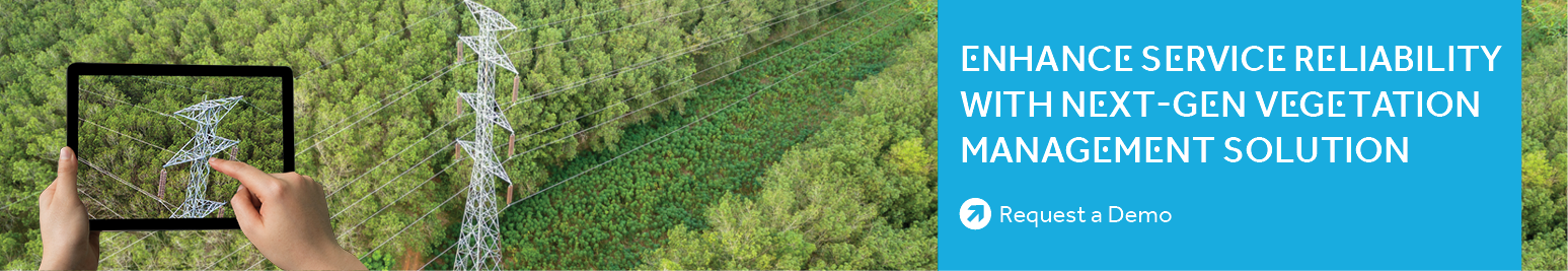
  • 3D modeling and simulation: Ultra-Dense Networks (UDNs), enabled by small cells, help improve the capacity and coverage of 5G signals. Telecom players can use 3D modeling and simulation for an accurate, real-time, and 360-degree view of a location, to aid in site identification, design, and construction of small cell infrastructure.
  • Geospatial insights for continuous improvement: Telecom operators can use terrain maps and infrastructure data to identify factors that impede services and impact the quality of 5G signals. Additionally, this can be used to enhance the design process, tweak it for efficacy, and to continuously monitor the quality of service.
  • Remote planning and monitoring: Geospatial visualization tools create a virtual environment that helps carry out network and infrastructure planning from the office, thereby reducing the number of site visits and time between plan, design, and build. Further, these tools provide insights into tower asset conditions, which enables the field crew to prioritize maintenance activities and optimize maintenance processes.

Utilities

Electric and gas utilities have become the lifelines for a majority of the world’s population. Any disruption in service throws work and life out of gear, especially in the current scenario where people are working from home and spending more time indoors. The utility sector is also vulnerable to breakdowns in an aging infrastructure, and absolute reliance on the field force for upkeep and maintenance. However, advances in geospatial solutions and analytics can aid utilities to deploy technology for the following tasks:

  • Using LiDAR data for digital twins:LiDAR data offers accurate and detailed information on several parameters, including location, distance, height, buildings, natural features, roads, and power lines, which can be used to create digital twins without being physically present. By reducing field force site visits, LiDAR helps utilities save time, reduce operational costs, and improve efficiencies in existing processes.
  • Remote vegetation monitoring:Any disruption in vegetation management and clearance schedules expose utility infrastructure to risks due to vegetation or other encroachments. Leveraging satellite and aerial imagery using Unmanned Aerial Vehicles (UAVs), and AI and ML technologies can help create 3D maps to identify threats and prioritize work.
  • Underground asset mapping and monitoring: Gas utilities have a vast network of underground pipelines and assets that require periodic surveillance and monitoring. While most companies resort to physical inspections, geospatial solutions help operators accurately map and monitor their underground assets from space without compromising on the reliability of data.

Ultimately, geospatial data by itself does not provide any recommendations or solutions. It is the analysis of that data using advanced AI/ML, the inferences, and the insights that outline the future course of action. Advanced geospatial technologies enable the remote capture of data, which can then be stored in the cloud, making the entire process location agnostic. These factors, combined with secure data, and the ability to process it anywhere, are likely to boost the use of geospatial analytics in the wake of the COVID-19 crisis.


Blog-Banner


Let Us Know What You Thought about this Post.

Put your Comment Below.

You may also like:

Geospatial , EV

Location-Analytics in Site Selection for EV Charging Stations

With global temperature rising, and greenhouse gases being emitted at an exponential rate, the need for greener technolo...

Location-Analytics in Site Selection for EV Charging Stations Cyient
Aerospace & Defense , Geospatial

Satellite Disruptors: New-Gen Players Are Proving Small is Big

In 2010, a team of former NASA scientists came together in an attempt to use data from space to understand life on earth...

Satellite Disruptors: New-Gen Players Are Proving Small is Big Cyient
Geospatial

Space Data: The New Frontier

In November 2022, Hawaii’s Mauna Loa volcano began erupting in the Moku‘āweoweo Caldera. The Mauna Loa, the largest acti...

Space Data: The New Frontier Cyient

Talk to Us

Find out more about how you can maximize impact through our services and solutions.*

*Suppliers, job seekers, or alumni, please use the appropriate form.