.png?width=774&height=812&name=Master%20final%201%20(1).png)

LandSENS Modules & Capabilities
GeoAI Deep Learning Automated Mapping,
Feature Extraction & Change Detection
Feature Extraction & Change Detection
Enabling organizations to harness the power of data, optimize workforce efficiency, and drive intelligent automation.

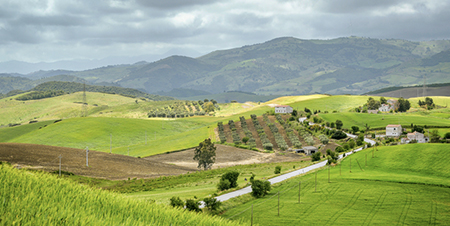
LandSENS combines advanced GeoAI deep learning mapping models and earth observation data cubes to support targeted client land monitoring requirements across a range of sectors. Using a proof-of-concept approach to solution development, our automated mapping services include the development of custom pre-trained models for rapid, on-demand mapping and anomaly detection on novel optical or SAR imagery.
- Custom sample library creation for model accuracy & robustness
- Rapid target feature mapping on demand once trained with or without ground truth data
- Ongoing model enhancements while in use operationally
Large-Scale Crop & Habitat Survey Management
Access a network of experienced specialists with end-to-end large-scale environmental survey management.
Our in-field environmental survey services include custom design and capture of ground control reference data, combined with processing pipelines to feed into machine learning and deep learning classification models.
- End-to-end national survey provision recruitment, planning & management
- Tailored survey formats to capture targets & % checks across multiple objectives
- Survey design & distribution to feed into automated mapping workflows
Computer-Assisted Photo Interpretation (CAPI)

Scalable computer-assisted photointerpretation infrastructure provides humans-in-the-loop expertise for high-volume digitizing, AI model annotation and complex change capture tasks.
Our CAPI service integrates automated and manual rules-based digitisation for asset and landscape feature monitoring with 100% quality control feedback loops.
- Automated Crop & Land Cover Mapping
- AI and ML-based Image Processing
Enabling organizations to harness the power of data, optimize workforce efficiency, and drive intelligent automation.
LandSENS combines advanced GeoAI deep learning mapping models and earth observation data cubes to support targeted client land monitoring requirements across a range of sectors. Using a proof-of-concept approach to solution development, our automated mapping services include the development of custom pre-trained models for rapid, on-demand mapping and anomaly detection on novel optical or SAR imagery.
- Custom sample library creation for model accuracy & robustness
- Rapid target feature mapping on demand once trained with or without ground truth data
- Ongoing model enhancements while in use operationally
Access a network of experienced specialists with end-to-end large-scale environmental survey management.
Our in-field environmental survey services include custom design and capture of ground control reference data, combined with processing pipelines to feed into machine learning and deep learning classification models.
- End-to-end national survey provision recruitment, planning & management
- Tailored survey formats to capture targets & % checks across multiple objectives
- Survey design & distribution to feed into automated mapping workflows
Scalable computer-assisted photointerpretation infrastructure provides humans-in-the-loop expertise for high-volume digitizing, AI model annotation and complex change capture tasks.
Our CAPI service integrates automated and manual rules-based digitisation for asset and landscape feature monitoring with 100% quality control feedback loops.
- Automated Crop & Land Cover Mapping
- AI and ML-based Image Processing
Impact in the Real World
Ecological & Habitat Monitoring at Scale
Since 2007, Cyient Europe has worked with a leading UK government agency to digitize land management and deliver geospatial intelligence at national scale. Using deep learning models trained on APGB 25cm aerial photography and high-frequency 3m PlanetScope data, we’ve developed GeoAI solutions to detect habitats and features like grass buffers and nesting plots. This approach enables faster, more accurate mapping, powering biodiversity, carbon capture, and soil health goals while reducing costly field surveys.

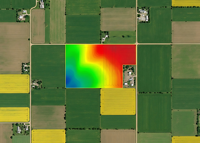
Pre-trained model results from Picterra for hedgerows, trees and grass verges around cropped extents predicted on APGB satellite imagery.
.png)
.png)