.png?width=774&height=812&name=Master%20final%201%20(1).png)
.jpg?width=1680&height=800&name=Frame%20905%20(15).jpg)
.jpg)
Intelligent Engineering
with Cyient
.png)
Network Data
Management
.png)
Field Service
Management
.png)
Integrated
Operations
Impact in the real world

Improving Gas Network Accuracy with ArcGIS
Enhancing Utility Operations with Precision LiDAR Services

Transforming Network Management with Esri’s UN Enterprise GIS

Standardizing WFM/FSM with ServiceNow Integration

Cloud-Based Transformation for Enhancing Enterprise Workforce Management

Smart Meter Analytics + GIS Integration: Powering a 20% Boost in Utility Efficiency

Cloud App Security Management: Automating IoT & Ensuring Compliance for Water Utilities
In the Spotlight

Esri Recognizes Cyient’s Innovation
Standardized Utility Network for a US-Based Energy and Water Provider

Enterprise GIS Implementation for a Leading UK Water Utility

Enhanced Outage Management for a New Zealand Utility
Insights
Press Release
Cyient Receives Esri’s “Release Ready Specialty” Partner Status
Press Release

Cyient Attains Gold Status in the Esri Partner Network
Press Release

Cyient Receives Modern Network Management Award at Esri Infrastructure Management and GIS Conference
Impact in the Real-World
Improving Gas Network Accuracy with ArcGIS
Our implementation of Positional Accuracy Improvement (PAI) with the loading of input datasets into ArcGIS enhanced the customer’s spatial accuracy by up to 98%

Customer Challenge
The customer strategized to implement the Esri Utility Network Enterprise GIS for an enhanced network management.
Outcome Delivered
Effective implementation of UN migration accelerated ADMS go-live for the customer to start managing network and operational challenges efficiently.
Cyient Solution
- Implemented standardized Esri’s UN data model for electric, gas and water / wastewater.
Deployed and configured Esri’s ArcGIS Enterprise and ArcGIS Pro in an enterprise cloud infrastructure. - Converted and migrated data from legacy systems to UN model for gas, electric and water / wastewater.
- Integration and interfaces to advanced applications such as Mobile GIS viewer, Synergi and Cyme.
- Configuration of Esri’s Leak Survey, Relight and Esri apps such as Navigator, Collector for ArcGIS and Survey123.
- Provided support and maintenance post go-live for the hosted GIS solution for a five-year period.
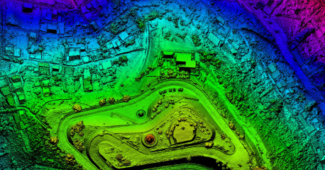
Enhancing Utility Operations with Precision LiDAR Services
Our Top Eye system captured LiDAR/ Imagery with forward and vertical digital cameras, resulting in improved infrastructure management for the customer
The customer executed a 10-year master plan for their Corporate Geospatial Information System (CGIS) to support property management, security, logistics, and the management of their fiber optic network.
Outcome Delivered
- Improved asset management through a centralized consolidated GIS.
- Easy viewing, querying and report generation.
- Improved operational efficiency.
Cyient Solution
- Implemented Service Oriented Architecture (SOA) based Enterprise GIS solution on GE Smallworld EO.
- Data modeling and data migration into GE Smallworld.
- Developed applications for asset planning, construction, management, maintenance and customer. management across all customer divisions like distribution, transmission, generation, ICT, system planning and corporate services.
- Integrated GIS with the rest of the corporate systems in a SOA based environment using Oracle ESB.
Transforming Network Management with Esri’s UN Enterprise GIS
Our effective implementation of UN migration accelerated ADMS go-live for the customer to start managing network and operational challenges efficiently
The customer strategized to improve accuracy of land base of the gas network, which had an impact on over 44,000 km of our customer’s gas network.
Outcome Delivered
Customer achieved high level of spatial accuracy of up to 98%.
Cyient Solution
Implemented Positional Accuracy Improvement (PAI) with the loading of input datasets into ArcGIS.
Inspected features, feature classes, relationships between them, and the geo database topology.
Utilized Workflow Manger application for efficient and faster data processing.
Implemented data processing in three modules:
- Network data analysis and recording the relationships between old and new OS land base data in the input database.
- Realigning the network data against the post-PAI map using advanced PAI tool.
- Calculating the quality metrics and doing QA for optimally positioning the data.
Standardizing WFM/FSM with ServiceNow Integration
We helped streamline work scheduling, digitize major process and field data collection using mobile forms, and improved inventory management for a leading energy and gas utility
A leading energy and gas utility selected the ServiceNow platform for the WFM/FSM Digital transformation.
Outcome Delivered
- Streamline the existing process.
- Multi-day project management.
- Integration of Asset information and Historical data from SAP, GIS etc.
Cyient Solution
- Cyient provided Architecture, Development services, Integration with SAP, GIS, EIM.
- Integrating silo-based process across multiple BU, Standardization of existing process and Digitization of the forms.
The following are the key features of the solution:
- Work Scheduling.
- Digitization of Major Process and field data collection using mobile forms.
- Inventory Management.
Cloud-Based Transformation for Enhanced Enterprise Workforce Management
We transformed a major utility service provider’s existing legacy MWS application into a cloud-based application for accommodating future business needs
A major utility service provider planned to transform their existing legacy MWS application to a cloud-based application to accommodate their future business needs.
Outcome Delivered
- Transformation of silo based legacy home-grown application into an integrated solution with more efficient enterprise workforce management.
- Efficient Claim process and Settlement handling.
- Optimized Salesforce license by creating community users for the Claim and Settlement process.
- Delivered improvised Customer Experience using Salesforce experience cloud to the consumer segment.
Cyient Solution
- Better scheduling of Field Service Technician for optimum utilization.
- Streamline claim process.
- Better reporting across the Field Service activities.
- Consolidate and transform the current siloed disparate systems.
Smart Meter Analytics + GIS Integration: Powering a 20% Boost in Utility Efficiency
We integrated smart meter analytics with GIS, to enhance monitoring, and ensuring seamless compatibility with ESRI-based GIS services for better operational efficiency
- Increase the efficiency of existing system, to meet the regulatory requirement
- Increase operational efficiency and cope with their clients’ ESRI based GIS services.
- Upgrade their framework and provide better integration of GIS services of their clients.
Outcome Delivered
- 20% increase in operational efficiency (vis-à-vis baseline levels).
- Time-slider functionality helped to display dynamic changes in voltage and load consumptions either for a customer or a transformer.
- Better analysis of transformers for additional load based on new connection.
- System reliability enhancement.
Cyient Solution
- Developed grid analytics application to enhance the existing product framework.
- Developed operational awareness application to monitor read rate of each smart meter.
- Customer service representative interface to provide meter, billing data and cost information to their customers.
- Implemented smart grid analytics to outline and analyze the smart meter data.
- Integrated the client’s analytics framework with GIS.
Cloud App Security Management: Automating IoT & Ensuring Compliance for Water Utilities
We assessed the cloud platform to identify risks, integrate security tools, and automate pipeline processes to secure IoT operations for water utilities
Scope
- Application is to regulate and manage pumps, water levels and associated utilities.
- Application Security Implementation recommendation, remediation and Cloud posture management for IoT Orchestration and Monitoring Platform.
- Analysis, Configuration, Integration and management of Security and Quality Assurance tools.
Benefits
- Pipeline configuration for automation and streamlining the development process to capture the potential issues and vulnerabilities at earlier stages of development.
- Secure by design approach adoption
Technical Solution
- Assessment of the Cloud platform for identifying the potential risks in the application.
- Analyze and integrate standard tools for securing the product in development environment
- Configuration and Integration of new tools and process to improve the quality, compliance and security of the solution.
- Provide recommendations to the development team for hardening and define critical controls and procedures required.
- Integrated tools report analysis to identify the potential risks and mitigate them to make the product free of vulnerabilities and maintaining the best practices.