Accurate and readily available inspection data is critical for effective asset management in rail. The need for safer and more efficient inspection of railway assets is steering companies to consider a range of emerging digital technologies. Our deep domain expertise in both rail and geospatial services is complemented by our agile and innovation-driven approach to developing intelligent digital rail solutions as part of the rail industry’s journey toward Mobility 4.0.


Cyient’s Infrastructure Services and Solutions

Aerial Photography

Fixed-wing and rotary wing aerial photography and videography for inspection purposes.

Hyperspectral Imaging

Hyperspectral imaging in VNIR, NIR, and SWIR wavelengths.

LiDAR

Fixed-wing and rotary wing LiDAR data capture, processing, and ortho creation.

Mobile Laser Scanning

Highly accurate surveying system for signage detection, topographic mapping, vegetation, and encroachment management.

Image Assisted Inspection

Encroachment management, anomaly detection 


Infrastructure Planning & Inspection Services

Aerial Photography

Fixed-wing and rotary wing aerial photography and videography for inspection purposes.

Hyperspectral Imaging

Hyperspectral imaging in VNIR, NIR, and SWIR wavelengths.

LiDAR

Fixed-wing and rotary wing LiDAR data capture, processing, and ortho creation.

Mobile Laser Scanning

Highly accurate surveying system for signage detection, topographic mapping, vegetation, and encroachment management.
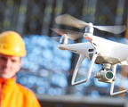
Infrastructure Inspection Solutions

Image Assisted Inspection

Encroachment management, anomaly detection 


Talk to Us

Find out more about how you can maximize impact through our services and solutions.*

*Suppliers, job seekers, or alumni, please use the appropriate form.